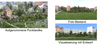
Visualisations
Capturing the real environment - representing new designs in image, film and rendered reality.
Visualisations
Capturing the real environment - representing new designs in image, film and rendered reality.
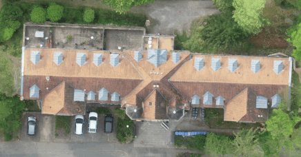
Data collection with drones, laser scanners and other photos
Photos are the basis for terrain models, visualisations, as-built drawings, volume calculations, sections, measurements, invoicing, expert opinions, 3D printing...
Photogrammetry, orthophotos, videos real and rendered.
Use of own photos is possible.

Scan360 GmbH
Ingenieurbüro für 3D Dokumentation
Mettelbachstrasse 42
74076 Heilbronn
Germany
Phone +49 (0)7131 3943880
Email info@scan360.de
www.scan360.de